Mapping out your success
The Geographic Information Systems Minor at Marietta College broadens a student’s professional opportunities — regardless of major. GIS allows individuals and organizations to capture, store, analyze and share spatial or geographical data. This information allows employers and agencies to identify trends and make informed decisions based on that data.
This emerging industry has generated 330,000 new geo-professional jobs over the last decade and is expected to grow by 30 percent over the next five years.


What You'll Learn While Earning a Minor in Geographic Information Systems
Marietta’s GIS program is taught through an interdisciplinary approach, so the minor complements academic concentrations from Arts & Humanities to Natural Sciences.
Hands-on Experience
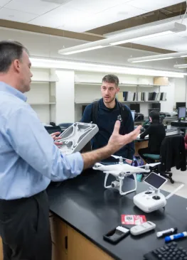
Dedicated faculty in the History, Geology and Biology departments teach courses in GIS mapping & analysis, geography, and statistics, and challenge students through hands-on, real-world projects that address common geographic issues.
Liberal Arts Education
Students pursuing a GIS minor also take elective courses in computer science, graphic design, marketing, or political science, and complete a related internship or a demonstration of a capstone research project.
FAQs
- Does the department accept AP credit toward the minor?
The department recognizes the accomplishments of students who have AP credit in geography. Any student who scores a 4 in AP Human Geography will get credit for HIST 220.
- Will I be required to complete an internship for the minor?
Yes, it is a requirement. However, a student may substitute a capstone project with demonstrated use of GIS with approval of the GIS Director.


